
Hiking the Laugavegur Trail: A Journey Through Iceland's Stunning Highlands

Hiking the Laugavegur Trail: A Journey Through Iceland's Stunning Highlands
The Laugavegur Trail is a 55-kilometer hiking route that traverses through Iceland's stunning Highlands, offering hikers an unparalleled adventure through some of the most beautiful landscapes in the world. This famous trail starts in Landmannalaugar, a geothermal wonderland in the heart of the Icelandic Highlands, and ends in Thorsmork, a lush valley surrounded by glaciers and mountains. In this blog post, we will explore what it's like to hike the Laugavegur Trail, and why it's a must-do for any outdoor enthusiast.
Getting Started
The Laugavegur Trail is typically hiked from north to south, starting in Landmannalaugar and ending in Thorsmork. The trail is marked with cairns and posts, and there are several huts and campsites along the way where hikers can take shelter and rest. Hikers should be prepared for a variety of weather conditions, as the weather in the Highlands can change rapidly and unpredictably.
Day One: Landmannalaugar to Hrafntinnusker
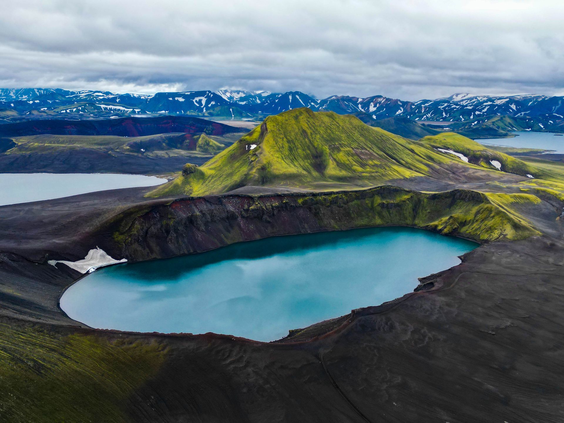
The first day of the hike takes hikers from Landmannalaugar to Hrafntinnusker, a distance of approximately 12 kilometers. This section of the trail is the most challenging, as hikers must ascend over 1,000 meters in elevation gain. Along the way, hikers will pass through a variety of landscapes, including colorful rhyolite mountains, geothermal hot springs, and vast lava fields.
Day Two: Hrafntinnusker to Álftavatn
The second day of the hike takes hikers from Hrafntinnusker to Álftavatn, a distance of approximately 12 kilometers. This section of the trail is less challenging than the first day, with mostly downhill and flat terrain. Along the way, hikers will pass through a variety of landscapes, including glacial valleys, snowfields, and small streams.
Day Three: Álftavatn to Emstrur
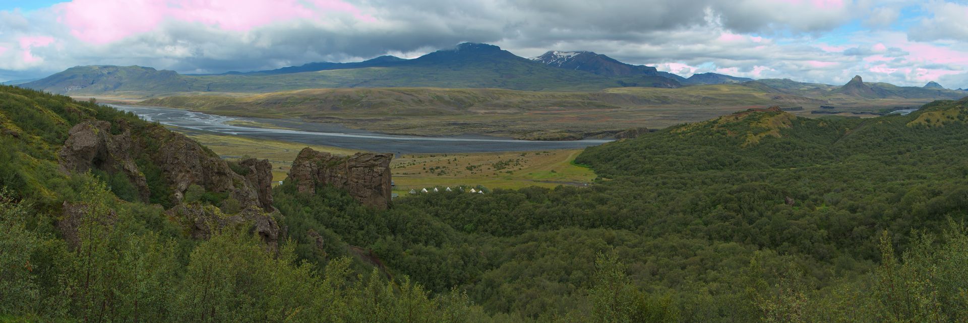
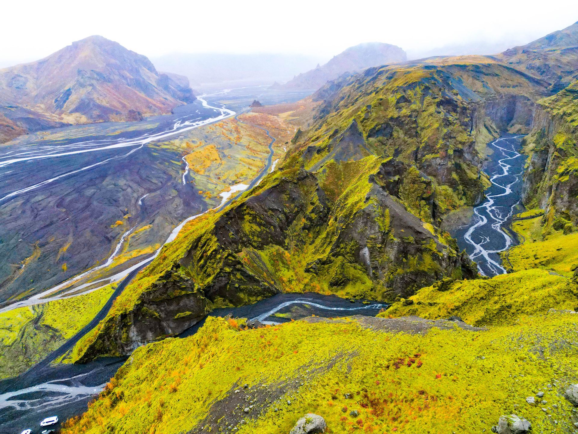
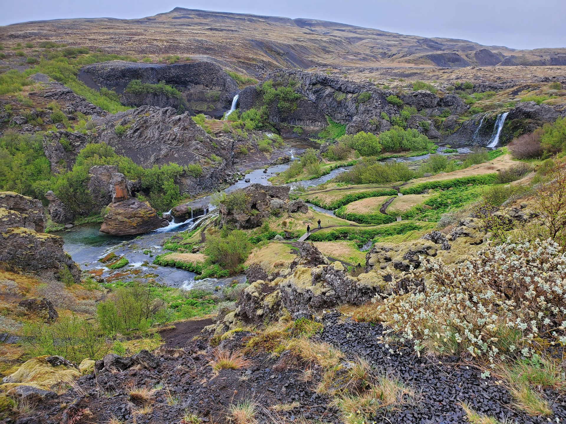
The third day of the hike takes hikers from Álftavatn to Emstrur, a distance of approximately 15 kilometers. This section of the trail is relatively flat, with gentle ups and downs. Along the way, hikers will pass through a variety of landscapes, including moss-covered lava fields, small rivers, and canyons.
Day Four: Emstrur to Thorsmork
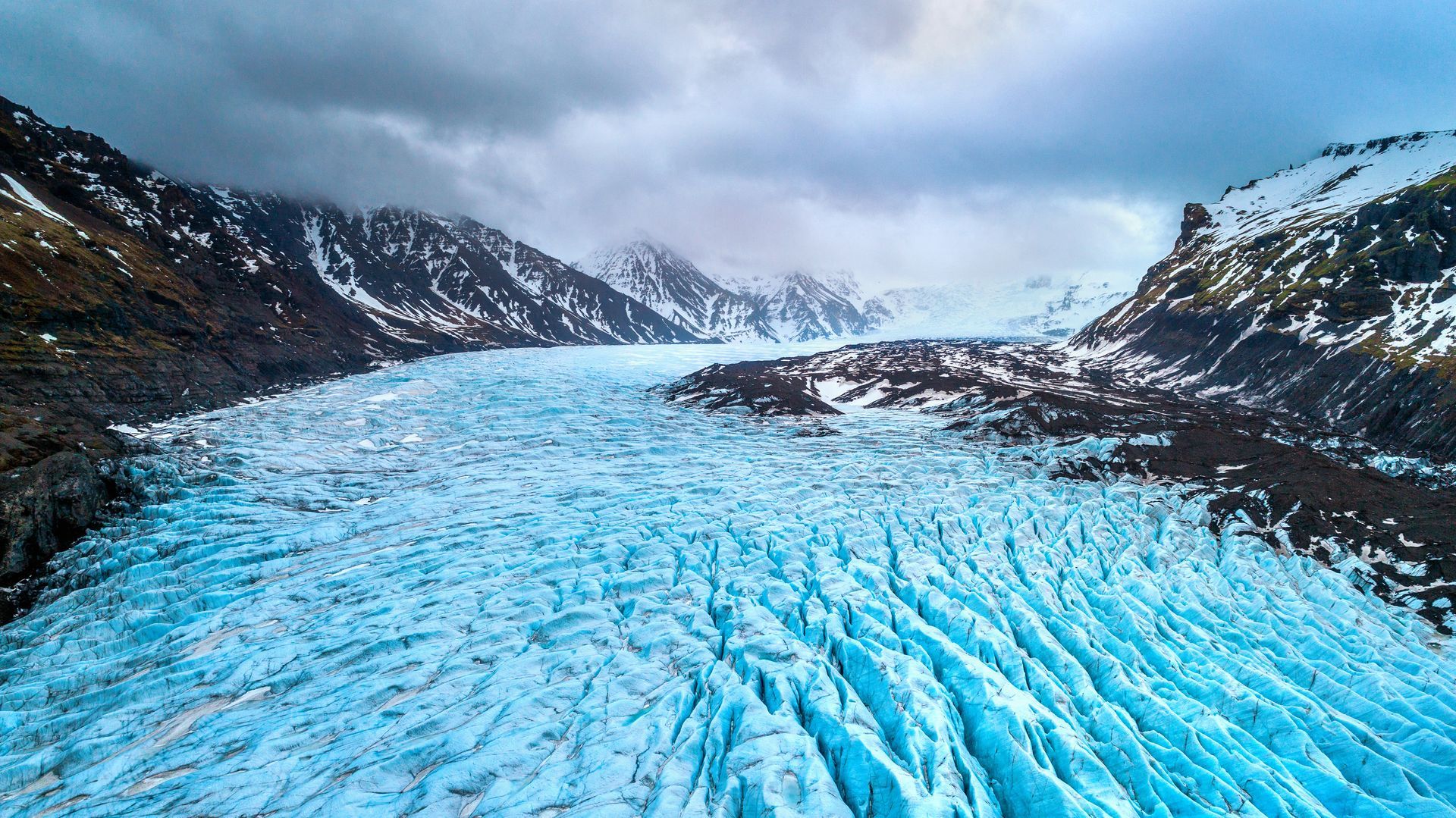
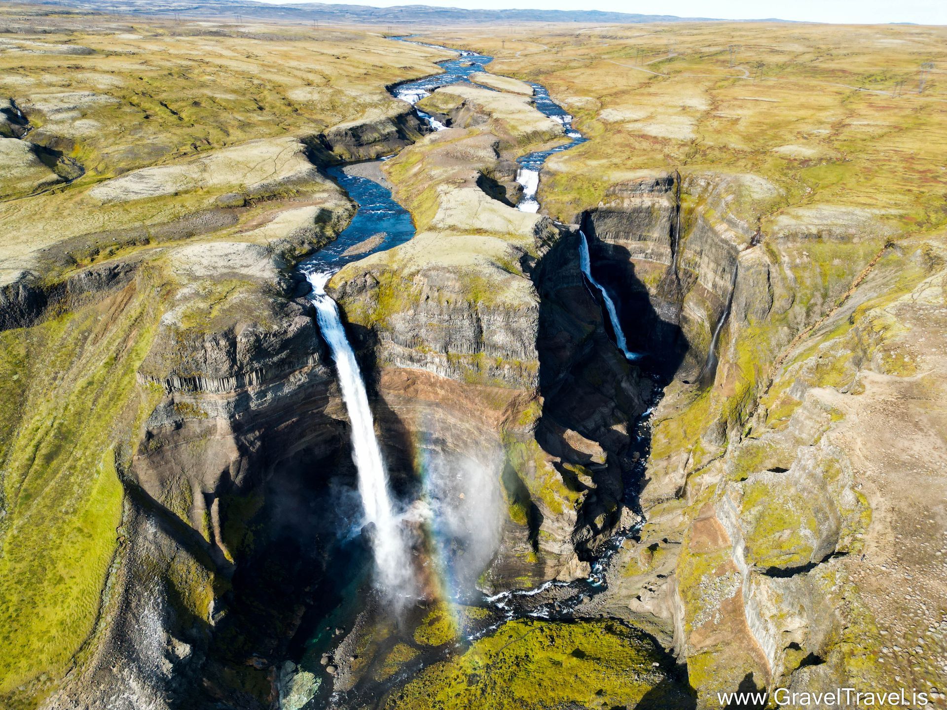
The fourth and final day of the hike takes hikers from Emstrur to Thorsmork, a distance of approximately 15 kilometers. This section of the trail is the most scenic, with stunning views of glaciers, mountains, and forests. Along the way, hikers will cross several glacial rivers, which can be challenging to navigate depending on the water level.
What to Expect
Hiking the Laugavegur Trail is a challenging and rewarding experience. The trail offers hikers a chance to see some of the most beautiful landscapes in Iceland, including colorful mountains, geothermal hot springs, and vast lava fields. Hikers should be prepared for a variety of weather conditions, as the weather in the Highlands can change rapidly and unpredictably. It's important to pack warm clothing, rain gear, and sturdy hiking boots.
Accommodations
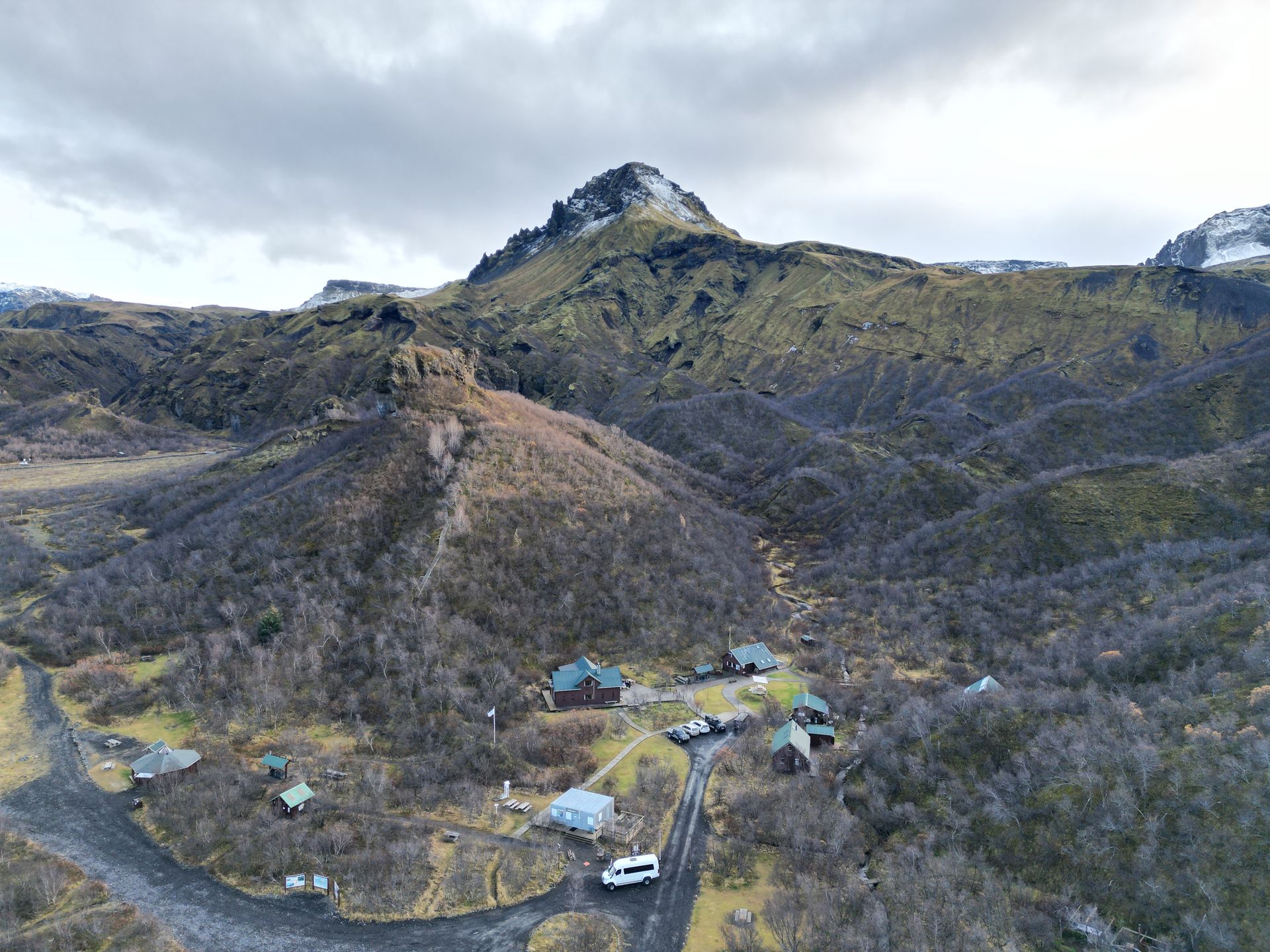
There are several huts and campsites along the Laugavegur Trail where hikers can take shelter and rest. The huts offer basic accommodations, including bunk beds and cooking facilities. The campsites offer space for tents and some have basic facilities, such as toilets and showers. It's important to book accommodations in advance, as they can fill up quickly during peak in the summers

CONTACT INFO
+3547885566
info@graveltravel.is
USEFUL LINKS
FOLLOW US